Particuba - Sierra Maestra |
DERNIÈRE Retour à Galerie |

|
|
|||||||||||
|
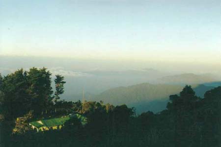
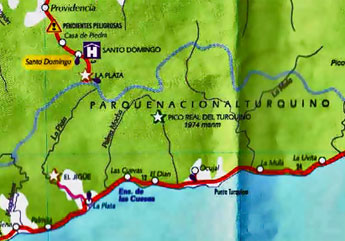
Marche dans la Sierra Maestra de l'entrée du parc national Pico Turquino au sommet et le monument à José Marti Prévoir de l'eau et des snacks, fruits et sucreries; on peut louer un âne pour transporter les sacs à dos pour la première étape entre Santo Domingo et Aguada de Joaquin. La montée et la descente se font à pied assez facilement en 2 à 3 jours, sans équipement spécial. Pour accéder au parc Parque nacional Pico Turquino, on se rend à Santo Domingo (porte d'accès, côté nord, accessible en passant par Bartolomé Maso, au départ de Bayamo, entre autres). À l'agréable auberge de montagne, on passera la nuit précédente. La montée jusqu'à l'entrée du parc à Alto Naranjo (altitude 950 m) est assez extraordinaire à un angle de 45% (en auto ou bus spécial). On paie les frais d'accès (33 à 48cuc pp, avec ou sans repas) puis on obtient les services d'un guide. Faut ce faire avant 10 heures car l'administration ferme le guichet sans faute à cette heure. La marche jusqu'à La Comandancia prend une heure (à 3 heures aller-retour) environ. Cette seule excursion coûte 11cuc. Un autre sentier bien balisé, comporte des bouts avec des marches et passe par la petite communauté de La Plata qui vit de la culture du café. Le sentier mène en 5 heures à Aguada de Joaquin, un des rares points d'accès pour faire le plein d'eau. La nature est exhubérante avec plusieurs sites d'observation d'oiseaux et de papillons. On trouve à Aguada de Joaquin un hébergement assez basique (dortoir pour 16 personnes max.) avec cuisine que les montagnards préparent pour les marcheurs. Si la génératrice fonctionne, la télévision aussi; toilettes et douche pour se rafraîchir. Sinon, on peut utiliser la source tout près. 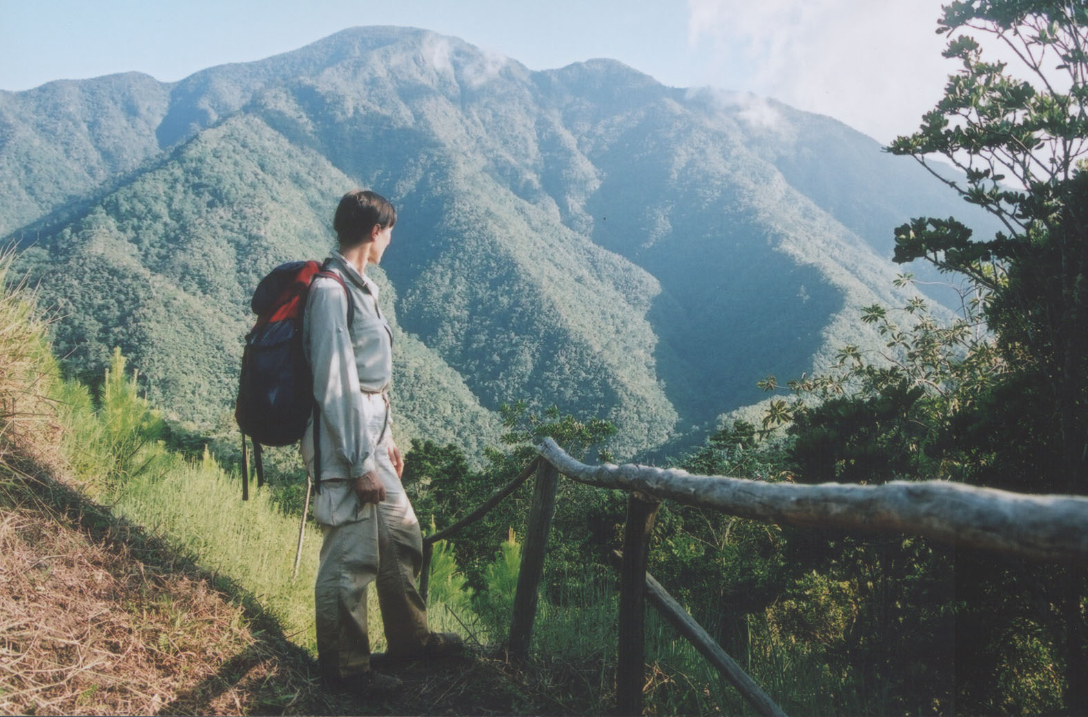 Départ au lever du soleil pour le trek final. Le premier sommet — atteint en une heure — s'appelle Joaquin puis ce sont trois autres heures de hauts et de bas — la partie la plus ardue de l'excursion — et une montée par des échelles en bois fabriquées sur place : c'est « Le col des singes ». Peut-être nommé ainsi parce que plusieurs grimacent d'efforts ... On atteint le sommet, Pico Turquino vers midi. Les vues sont inexistantes car le couvert d'arbres est trop intense; il y a un bon point d'observation en contrebas qui permet d'apercevoir la mer. On trouve au sommet un buste de José Martì. Quelque soit leur orientation politique, les Cubains sont unanimes : Marti est leur héros national. Retour On redescend en un après-midi en passant par le sud en direction de la mer vers le point final, le petit village de Las Cuevas. Alternative pour les moins hardis : il y a un hébergement après une heure de descente, à La Majagua, station de forêt, juste après Pico Cuba. Il faut prévoir un transport de retour depuis Las Cuevas jusqu'à son point de départ : Bayamo 205 km au nord via Manzanillo, Manzanillo 145 au nord-ouest via Pilon et Media Luna, Santo Domingo 196 au nord via Manzanillo Bartolomé Maso 178 au nord via Manzanillo et Yara Marea del Portillo à 42 km à l'ouest Pilon 57 km à l'ouest Santiago de Cuba 120 km vers l'est Chivirico 52 km à l'est) car on ne veut pas attendre un bus qui ne passera pas et il n'y a pas de poste de taxi à Las Cuevas ...
|
Trek to Pico Turquino (1,974m - 6,476ft)
Hiking in the Sierra Maestra National Park from its entrance to Pico Turquino and the monument to Jose Marti. Bring lots of water and snacks, fruits and sweets, you may be to rent a donkey to carry the backpack.aThe ascent and descent are easy walks doable in 2 to 3 days, without special equipment. To access the Parque Nacional Pico Turquino, we went to Santo Domingo (access through Bartolome Maso, from Bayamo or Manzanillo). Overnight at casa particular Ulice or at the cozy mountain inn. The climb up to the entrance of the park Alto Naranjo (altitude 950 m) is quite extraordinary at an angle of 45% (by car or bus special). Access charges for the park (33-48cuc pp, with or without meals) are paid and the services and we get a mandatory guide. This should be done before 10 o'clock because the administration closes the window without fault at this time. Walking up the Comandancia takes an hour (3 hours return) approx. This tour costs only 11cuc. Another well-marked trail, includes tips with steps and through the small community of La Plata which lives growing coffee. The trail leads over 5 hours to Aguada de Joaquin, one of the few access points to fill with water. Nature is exuberant with several birding and butterfly sites. In Aguada de Joaquin, some fairly basic accommodation (dormitory for 16 people max.) with kitchen facilities a DIY for trekkers. If the generator is running, the TV also works, toilet and shower to cool off. Otherwise, you can use a water source nearby. We reached the summit, Pico Turquino at noon. The views are nonexistent because the canopy is too intense, there is a good vantage point below from which one can see the sea. It sits atop a bust of José Martì. Whatever their political orientation, Cubans are unanimous : Marti is their national hero. The bust was planted there by Celia Sanchez' dad.
|
|||||||||||
|
||||||||||||